
What is the danger?
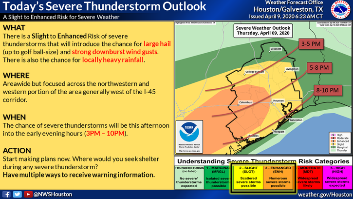
According to the National Weather Service, severe weather is expected across southeast Texas this afternoon and evening as a cold front moves through the area. Widespread rainfall of 0.5-1 inches is expected, however, rapid rainfall of up to 3-5 inches over a short period could lead to street flooding and rises on creeks and bayous. Strong winds and large hail are possible with this system.
 What you should do:
STAY HOME
- Stay Home, Work Safe order is in effect: do your part by staying home!
- If you must drive, stay safe:
- NEVER drive into flooded roadways.
- Have lights and wipers on.
- Allow extra braking distance and more time for your commute.
GET PREPARED
- Bring pets inside.
- Move your vehicle under cover, if possible.
- Secure loose objects in your yard.
- Have a flashlight, NOAA Weather Radio and extra batteries in case you lose power.
BE INFORMED
- Monitor the weather throughout the afternoon and evening.
- Get updates from trusted sources such as: National Weather Service Houston-Galveston, Harris County Flood Control District, and ReadyHarris.
- Power outages are possible anytime high winds occur. Track outages using the CenterPoint Energy Outage Tracker at ReadyHarris.
- Have a way to get emergency alerts throughout the evening by enabling your cell phone’s emergency alerts feature.
Text CV19 to 888777 to receive COVID19 updates.
Where you can learn more:
- Local Weather: National Weather Service Houston-Galveston
- Road Conditions: Houston TranStar