Tropical Storm Bertha Path: Texas and Katy Update
Bertha is following an unusual coast-hugging route that could carry the storm from Louisiana toward the upper Texas coast before it weakens inland.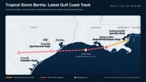
By Staff Editor
Updated: July 23, 2026, at 12:23 a.m. CDT
KATY, Texas — Tropical Storm Bertha made landfall in southeastern Louisiana Wednesday afternoon and is now moving west along the Gulf Coast, placing portions of the upper Texas coast under a tropical storm warning.
The storm came ashore at approximately 2 p.m. CDT near the Biloxi Wildlife Management Area in St. Bernard Parish, Louisiana. Bertha had maximum sustained winds of 45 mph at landfall, according to the National Hurricane Center’s landfall update.
By 10 p.m. Wednesday, Bertha’s center was about 75 miles southwest of New Orleans and 135 miles east-southeast of Lake Charles. The storm continued moving west at 12 mph with maximum sustained winds of 45 mph and a minimum central pressure of 1002 millibars.
The National Hurricane Center extended a tropical storm warning westward to Sargent, Texas. The warning now stretches from the Alabama-Mississippi border to Sargent and also includes metropolitan New Orleans and Lake Pontchartrain.
Where is Tropical Storm Bertha headed?
Bertha is expected to remain close to the Louisiana coastline before briefly moving over the northwestern Gulf and approaching the upper Texas coast Thursday.
The National Hurricane Center’s current forecast positions are:
- 7 a.m. Thursday: Near 29.2°N, 92.8°W along coastal Louisiana, with winds near 45 mph.
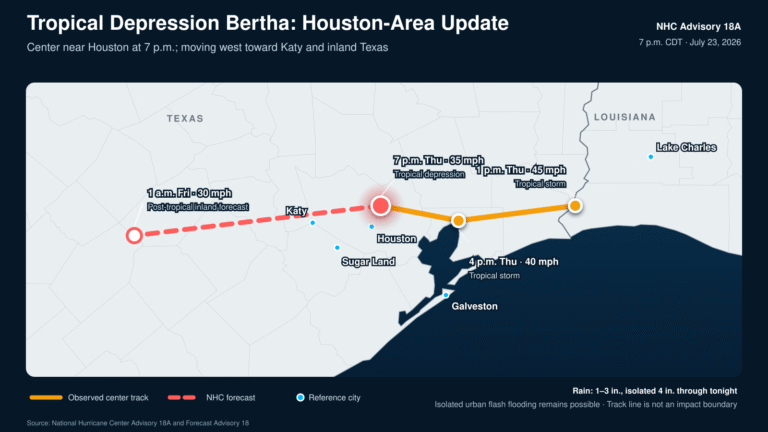
- 7 p.m. Thursday: Near 29.1°N, 95.6°W and inland along the upper Texas coast, with winds near 40 mph.
- 7 a.m. Friday: Near 29.0°N, 98.3°W over inland Texas as a remnant low, with winds near 30 mph.
- Friday evening: Expected to dissipate over Texas.
The forecast places Bertha near the dividing line between a weak tropical storm and a tropical depression as it reaches Texas. The storm is expected to weaken quickly after moving inland. The complete coordinates and intensity forecast are available in NHC Forecast Advisory 15.
Residents should remember that the forecast line only shows the expected location of the storm’s center. Tropical-storm-force winds extended as far as 160 miles from Bertha’s center Wednesday night, although the storm’s strongest winds and thunderstorms remained unevenly distributed.
What does Bertha mean for Katy?
A direct landfall in Katy is not expected under the current forecast.
Based on the National Hurricane Center’s Thursday evening forecast coordinates, Bertha’s center would pass approximately 50 miles south of Katy as it moves inland. That distance is an estimate based on the published forecast point, and the track could still shift.
Katy and western Harris County could experience passing tropical showers, brief heavy downpours and occasional gusty winds Thursday into Thursday night. However, the strongest winds, roughest marine conditions and greatest coastal flooding risk are expected closer to the Gulf Coast.
Katy is not part of the coastal tropical storm warning area identified in Advisory 15. Residents should still monitor alerts because even a relatively weak tropical system can produce localized street flooding when a slow-moving rain band passes over the same area.
The National Weather Service Houston/Galveston office is advising people in vulnerable coastal areas to complete preparations. Chambers County and coastal portions of Galveston and Brazoria counties are among the areas being closely monitored.
Bertha’s main threats along the Texas coast
Heavy rainfall and localized flooding
Bertha could produce 2 to 4 inches of rain along portions of the Texas Gulf Coast and South Texas through Thursday night. Isolated locations could receive up to 6 inches.
The greatest rainfall totals are not currently forecast for Katy, but localized flash flooding remains possible where heavier tropical bands develop over urban areas.
Storm surge and coastal flooding
Water levels could rise 1 to 3 feet above normally dry ground from the Alabama-Mississippi border westward to Port Bolivar, Texas. Similar water levels are possible around Lake Pontchartrain.
Minor coastal flooding may affect low-lying roads, parking lots, beaches and areas near bays or tidal waterways.
Dangerous surf and rip currents
Swells generated by Bertha will continue moving westward along the Gulf Coast. These swells could create life-threatening rip currents, even at beaches experiencing relatively calm weather.
Anyone planning to visit Galveston or another Gulf-facing beach should check local beach warnings and remain out of the water when red flags or beach hazard statements are posted.
Gusty winds
Tropical storm conditions are expected across portions of the upper Texas coast Thursday. Stronger gusts could bring down small tree limbs, move unsecured outdoor objects and cause isolated power interruptions near the coast.
Why significant strengthening appears unlikely
Bertha has struggled against dry air and persistent wind shear. Those conditions have pushed most of the storm’s thunderstorms south and southwest of its circulation center, leaving the system elongated and poorly organized.
Although Bertha may spend a short period over Gulf waters Thursday, forecasters do not expect significant strengthening before it reaches Texas. The National Hurricane Center’s forecast discussion says continued wind shear and dry mid-level air should limit the storm’s ability to rebuild.
That uneven structure also helps explain why communities relatively close to the forecast center may experience very different conditions.
What Katy-area residents should do
Katy residents do not need to panic, but they should remain weather-aware Thursday.
- Charge phones and portable power banks.
- Secure lightweight outdoor furniture and decorations.
- Clear leaves or debris away from nearby drains.
- Avoid driving through flooded streets.
- Keep weather alerts enabled overnight.
- Check conditions before traveling toward Galveston, Freeport, Matagorda or other coastal communities.
- Follow official updates rather than relying only on social-media storm tracks.
The National Hurricane Center scheduled its next intermediate update for 1 a.m. CDT and its next complete advisory for 4 a.m. CDT Thursday.
Frequently asked questions
Did Tropical Storm Bertha make landfall?
Yes. Bertha made landfall at approximately 2 p.m. CDT Wednesday near the Biloxi Wildlife Management Area in St. Bernard Parish, Louisiana, with maximum sustained winds of 45 mph.
Will Bertha make another landfall in Texas?
The National Hurricane Center forecasts Bertha to move near or across the upper Texas coast Thursday before continuing inland. It could still be a weak tropical storm when it crosses the coastline.
Is Katy under a tropical storm warning?
No. The warning described in Advisory 15 applies to coastal areas extending west to Sargent, Texas. Katy remains outside that coastal warning area.
What is the biggest threat to the Houston and Katy area?
For inland communities, the primary concerns are passing heavy showers, localized street flooding and gusty winds. Coastal communities face additional threats from tropical-storm-force winds, rough surf, rip currents and coastal flooding.
This story will be updated as the National Hurricane Center releases new information.