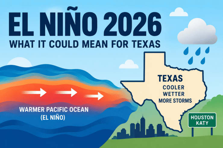
NOAA says a rapidly strengthening El Niño could become one of the strongest events observed in the modern record, raising questions about what the developing climate pattern could mean for Texas, Houston and Katy during the 2026–2027 winter.
The National Oceanic and Atmospheric Administration’s Climate Prediction Center currently has an El Niño Advisory in effect and says there is a greater than 90% chance of a very strong El Niño during the fall and winter of 2026–2027. Even more notable, NOAA says there is currently a 69% chance the event could reach a level exceeding previous El Niño events in records dating back to 1950 during the October through December period.
That does not guarantee an unusually cold, rainy or stormy winter in Katy. But historically, strong El Niño events have significantly shifted weather patterns across the southern United States — including Texas.
Is a Strong El Niño Developing in 2026?
Yes.
NOAA reported in its August 13 update that El Niño had strengthened significantly, with unusually warm water spreading across the equatorial Pacific Ocean.
Sea-surface temperature anomalies exceeded 2 degrees Celsius in portions of the eastern equatorial Pacific, while NOAA also detected significant warming beneath the ocean surface.
The combination of warm Pacific waters and changes in atmospheric circulation led NOAA scientists to conclude that the ocean and atmosphere are now firmly coupled in an intensifying El Niño pattern.
NOAA expects El Niño to continue strengthening through the end of 2026.
The next official NOAA ENSO Diagnostic Discussion is scheduled for September 10, 2026, meaning the probabilities could change as additional ocean and atmospheric data become available.
Is This a “Super El Niño”?
“Super El Niño” is a popular term used online and in some weather discussions, but it is not NOAA’s official classification.
NOAA describes the developing event as potentially “very strong.”
What makes the current forecast particularly noteworthy is NOAA’s estimate that there is a 69% probability that the October-December 2026 period could reach a level exceeding previous events in the historical record dating to 1950 under its current measurement system.
That makes the developing 2026 El Niño something Texans should watch closely heading into fall and winter.
What Does El Niño Usually Mean for Texas?
El Niño develops thousands of miles away in the tropical Pacific Ocean, but changes there can alter the jet stream and weather patterns across North America.
During a typical El Niño winter, the southern United States tends to experience cooler and wetter conditions than average, according to NOAA.
The pattern occurs partly because the Pacific jet stream tends to become stronger and extend farther across the southern United States, allowing more storm systems to travel across areas including Texas and the Gulf Coast.
However, NOAA repeatedly emphasizes that El Niño changes probabilities — it does not guarantee a specific weather outcome.
Two El Niño winters can behave very differently.
What Could El Niño Mean for Houston and Katy?
Historical data from the National Weather Service Houston/Galveston office provides an especially interesting picture for Southeast Texas.
A local NWS analysis examining El Niño and La Niña winters at Houston’s Bush Intercontinental Airport found that approximately 70.6% of El Niño winters experienced below-average temperatures.
The same study found approximately 76.5% of El Niño winters experienced above-average precipitation.
Those numbers do not mean there is a 70% chance Katy will have a cold winter or a 77% chance it will have a wet winter this year.
They show what happened historically during El Niño winters in the Houston area.
For Katy residents, a strong El Niño pattern could increase the possibility of periods of cooler temperatures, more frequent rain events and active storm systems moving across Southeast Texas.
Could Texas Have a Colder Winter in 2026–2027?
Possibly, but it is too early to predict individual cold fronts.
Historically, El Niño favors cooler-than-normal conditions across portions of the southern United States during winter. NOAA’s historical analysis shows that the southern tier of the country tends to be cooler and wetter during El Niño years.
Seasonal forecasts cannot tell residents whether Katy will be 35 degrees on a particular January morning.
They can only show whether the overall odds favor temperatures being warmer, cooler or near normal across a period of several months.
Does El Niño Mean Snow or Ice for Houston and Katy?
No.
A strong El Niño does not automatically mean Houston or Katy will experience snow, freezing rain or an Arctic outbreak.
Winter precipitation in Southeast Texas depends on several atmospheric conditions occurring at precisely the right time, including surface temperatures, temperatures higher in the atmosphere, available moisture and the position of individual storm systems.
Those conditions cannot reliably be predicted months in advance.
Residents should therefore be cautious about social-media posts claiming that El Niño guarantees a major Texas freeze, snowstorm or ice storm.
What El Niño can do is change the larger atmospheric pattern in ways that may increase certain weather probabilities.
Could Texas Receive More Rain?
This may be one of the more important effects to watch.
NOAA’s long-range outlook discussion says the national precipitation pattern becomes increasingly characteristic of El Niño as the 2026–2027 winter approaches, with increased probabilities for above-normal precipitation across portions of the southern United States.
Historical El Niño events have also frequently produced wetter conditions across portions of the South.
A stronger subtropical jet stream can carry Pacific moisture across Mexico and Texas before storm systems continue east toward the Gulf Coast and Southeast.
For the Houston metropolitan area, that could mean more frequent periods of clouds and rain than residents experienced during some recent dry winters.
Again, this is a seasonal tendency rather than a guarantee.
What About Hurricanes?
El Niño can also influence Atlantic hurricane activity because stronger upper-level winds can increase wind shear across parts of the tropical Atlantic.
NOAA currently says there are no active tropical cyclones in the Atlantic as of September 6, although hurricane season continues through November 30.
Residents along the Texas Gulf Coast should continue monitoring tropical weather regardless of the developing El Niño.
September is historically an important period of Atlantic hurricane season, and El Niño does not eliminate the possibility of a hurricane reaching Texas or another Gulf Coast state.
Katy Is Still Dealing With Summer Heat
Despite all the discussion about winter, residents should not expect fall temperatures immediately.
The National Weather Service forecast for Katy on September 6 calls for temperatures in the mid-90s, with heat-index values potentially reaching approximately 108 degrees. High temperatures are expected to remain around the mid-90s through the coming week.
That means Katy may still have several weeks of summerlike weather before significant seasonal changes become noticeable.
Why the 2026–2027 Winter Could Be Different
The most significant part of NOAA’s announcement isn’t simply that El Niño exists.
It is the potential strength.
NOAA says there is greater than a 90% chance of a very strong event this fall and winter and currently estimates a 69% probability that the October-December period could reach a historically exceptional threshold.
Stronger El Niño events can increase the likelihood that recognizable El Niño weather patterns develop.
They still cannot determine exactly what happens in Katy.
Individual cold fronts, Gulf storms, severe thunderstorms and winter precipitation events will depend on shorter-term weather patterns that become predictable days — rather than months — in advance.
What Katy Residents Should Watch
Several developments will become increasingly important as Texas moves deeper into fall:
NOAA’s September 10 El Niño update could change the projected strength of the event.
The Climate Prediction Center’s fall and winter temperature outlooks will provide updated probabilities for Texas.
Long-range precipitation forecasts will help determine whether Southeast Texas continues trending toward a wetter winter.
And once cold fronts begin reaching Texas, shorter-range National Weather Service forecasts will provide much more useful information about the possibility of freezes, severe thunderstorms or winter precipitation.
Frequently Asked Questions About El Niño 2026
Is there an El Niño in 2026?
Yes. NOAA has issued an El Niño Advisory and says El Niño is strengthening.
How strong could El Niño become?
NOAA says there is greater than a 90% chance of a very strong El Niño during fall and winter 2026–2027. NOAA also currently gives the October-December period a 69% chance of reaching a historically exceptional strength threshold.
Will Texas have a cold winter in 2026?
It is too early to know. El Niño historically increases the odds of cooler conditions across portions of the southern United States, but it does not guarantee a cold winter.
Will Houston have a wet winter?
Houston has historically experienced above-average winter precipitation during many El Niño years. An NWS Houston/Galveston analysis found above-average precipitation in approximately 76.5% of El Niño winters examined at Bush Intercontinental Airport.
Will it snow in Houston or Katy?
There is currently no reliable way to forecast a specific Houston or Katy snow event months in advance. El Niño alone does not guarantee snow.
When will NOAA update the El Niño forecast?
NOAA’s next ENSO Diagnostic Discussion is scheduled for September 10, 2026.
The Bottom Line for Katy
The 2026 El Niño is becoming one of the most important weather stories to watch heading into fall.
NOAA says the event is strengthening rapidly and could become historically powerful. For Texas and the Houston region, previous El Niño winters have often brought a greater tendency toward cooler and wetter conditions.
But residents should avoid interpreting seasonal forecasts as guarantees of freezes, flooding, snow or severe weather.