
What is the danger?
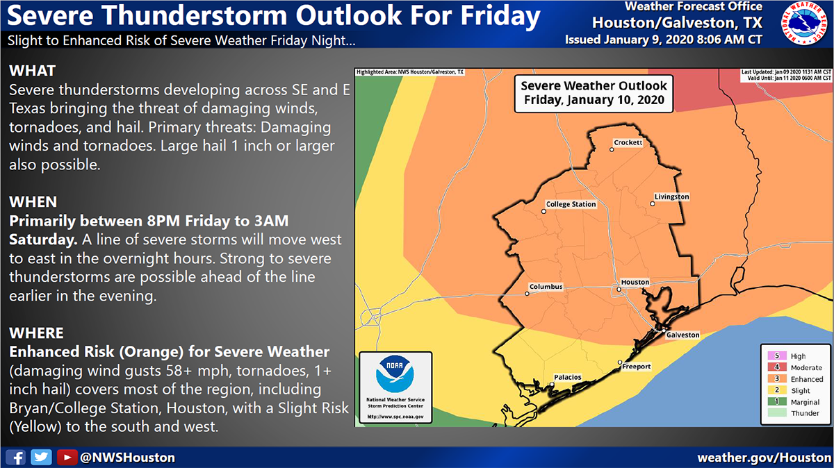
According to the National Weather Service, severe weather is expected across southeast Texas Friday night and early Saturday as a cold front moves through the area. Thunderstorms, strong winds, isolated tornadoes, hail and lightning are possible with this system. However, the majority of the event will take place after dark, likely between 10:00 pm Friday and 1:00 am Saturday. This is a fast moving system that will provide less warning time for impacts. It is extremely important that everyone have a way to receive emergency alerts throughout the night.
 What you should do:
PREPARE AT HOME BEFORE GOING TO BED
- Bring pets inside.
- Secure loose objects such as outdoor furniture or toys in your yard.
- Move your vehicle under a covered area, if possible.
- Have a flashlight, NOAA Weather Radio and extra batteries in case you lose power.
STAY INFORMED THROUGHOUT THE NIGHT
- Monitor the weather throughout the evening.
- Get updates from trusted sources such as: National Weather Service Houston-Galveston, Harris County Flood Control District, and ReadyHarris.
- Have a way to get alerts overnight by making sure your cell phone’s emergency alerts are enabled.
- Power outages are possible anytime high winds occur. Track outages using the CenterPoint Energy Outage Tracker at ReadyHarris.
ACT QUICKLY IF ALERTED
- If a Tornado Warning is issued, you need to act quickly!
- HOME: Move to a room on a lower floor, toward the middle of your house, that has no windows.
- DRIVING: Get off the road and find a place to shelter immediately. DO NOT stay in your vehicle and do not go under bridges/overpasses.
Where you can learn more:
- Local Forecast: NWS Forecast Office Houston/Galveston, TX